First Floor Elevation Mapping
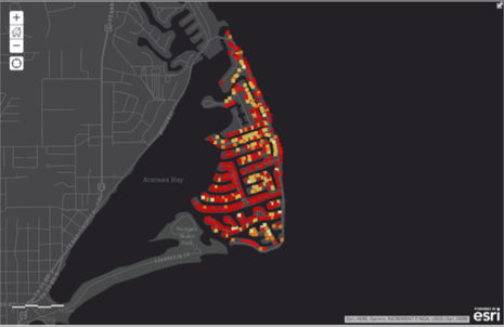
GIS Map of first floor elevations for Key Allegro, Texas
|
|
Marine Weather and Climate specializes in First Floor Elevation (FFE) Mapping. FFE levels vary considerably in most flood-prone communities from variations in both ground elevation and the height of buildings above ground. We use every source of data available, including field surveys, elevation certificates, street view analysis, drone flyovers and more.
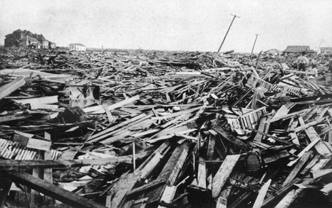
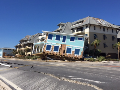
Comprehensive Flood History
|
|
Marine Weather and Climate specializes in creating comprehensive flood histories for flood-prone communities. We utilize every scrap of available information, including historic photos and videos, scientific reports, newspaper articles, diaries, journals and high water marks. We also do field work before, during and after flood events to document present-day floods. Pictures above are from Galveston after the 1900 Storm (Courtesy Rosenberg Library) and Mexico Beach, Florida after Hurricane Michael (2018)- courtesy Hal Needham.
Extreme Weather Field Work/ Expert Witness Testimony
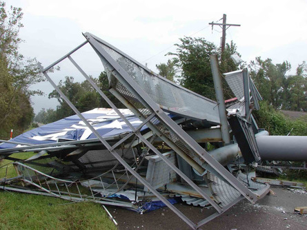
Hurricane Ike sheared off this billboard near Orange, Texas. on September 13, 2008. Photo: Hal Needham
|
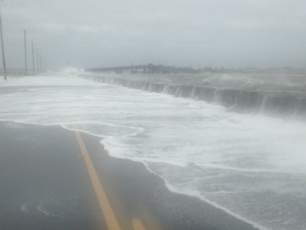
Strong onshore winds generated this storm surge in Avalon, New Jersey, on October 4, 2015. Photo: Hal Needham
|
Insurance litigation often gets messy following extreme weather events. Was the water damage in a home caused by storm surge entering at ground level or rain coming through the hole in the roof? Consider making a contract with Marine Weather & Climate to obtain field services this hurricane season. These contracts provide access to a qualified scientist to document and reconstruct multiple hazards from severe weather events.
Risk Assessment Reports
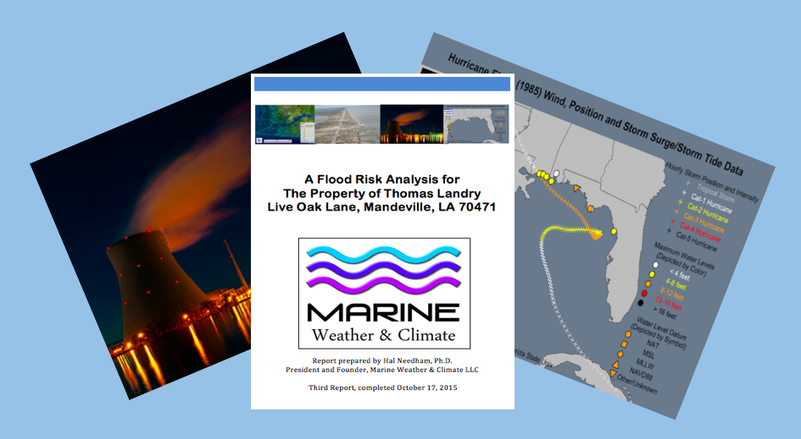
Our Risk Assessment Reports provide a comprehensive overview of site-specific risk, including historical data, statistical estimates and geospatial analysis. We have worked on such reports for everyone from individual property owners to nuclear power plant sites.
Extreme Water Level Analysis
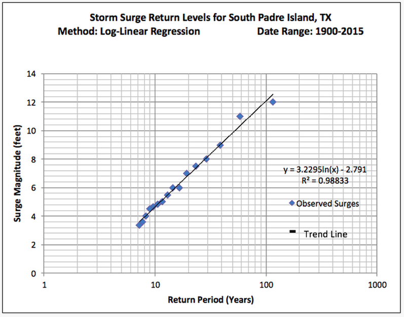
Marine Weather & Climate specializes in data-driven analysis of extreme events, This graph estimates the 100-year storm surge at South Padre Island, Texas, slightly exceeds 12 ft, based on water level observations since 1900.
