Marine Weather and Climate is excited about our partnership with Flood Information Systems for geospatial analysis, first floor elevation mapping and hurricane wind and flood risk analysis. Our partnerships with coastal communities makes them more resilient to coastal hazards.
First Floor Elevation Mapping
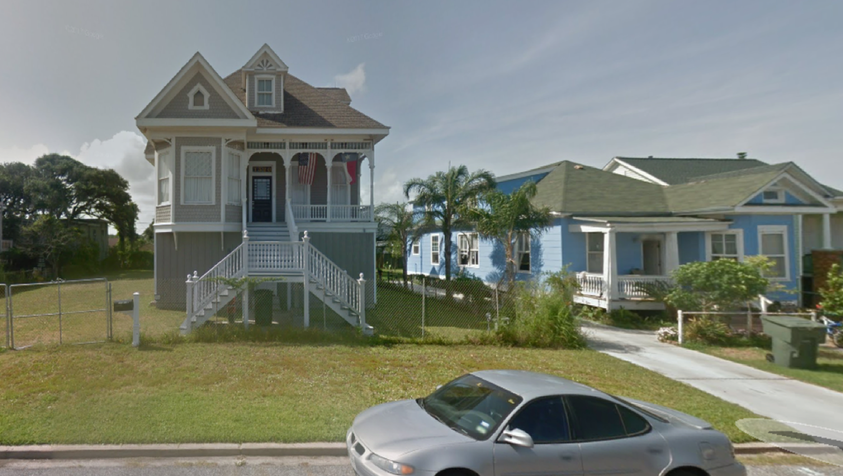
Flood impacts in coastal communities are difficult to assess because buildings are elevated to different levels. Marine Weather and Climate has partnered with Flood Information Systems to innovate technology that measures First Floor Elevation (FFE) through aerial and ground surveillance with advanced analytics.
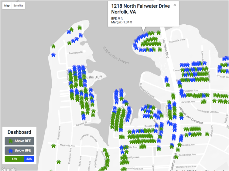
This interactive building map for an area in Norfolk, Virginia, shows the location of the 33% of buildings that are elevated lower than the Base Flood Elevation (BFE). Such maps reveal the location of the most flood-prone buildings in a community.
The U-Surge Project
U-Surge serves as the U.S. Storm Surge Database, providing the first data-driven coastal flood analysis for more than 50 cities from Texas to Maine. U-Surge depends upon robust observations from scientific equipment, government reports, field observations and anecdotal sources. We have added Black Swan Analytics to our innovative analysis to provide more comprehensive risk assessment.
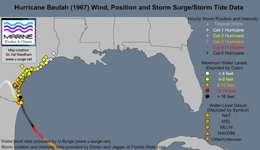
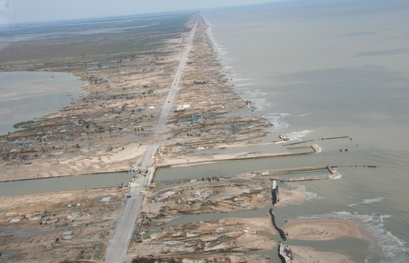
Storm tide map of Hurricane Beulah (1967). Beulah inundated the entire Texas Coast with saltwater, with peak storm tide levels exceeding 16 feet in extreme South Texas.
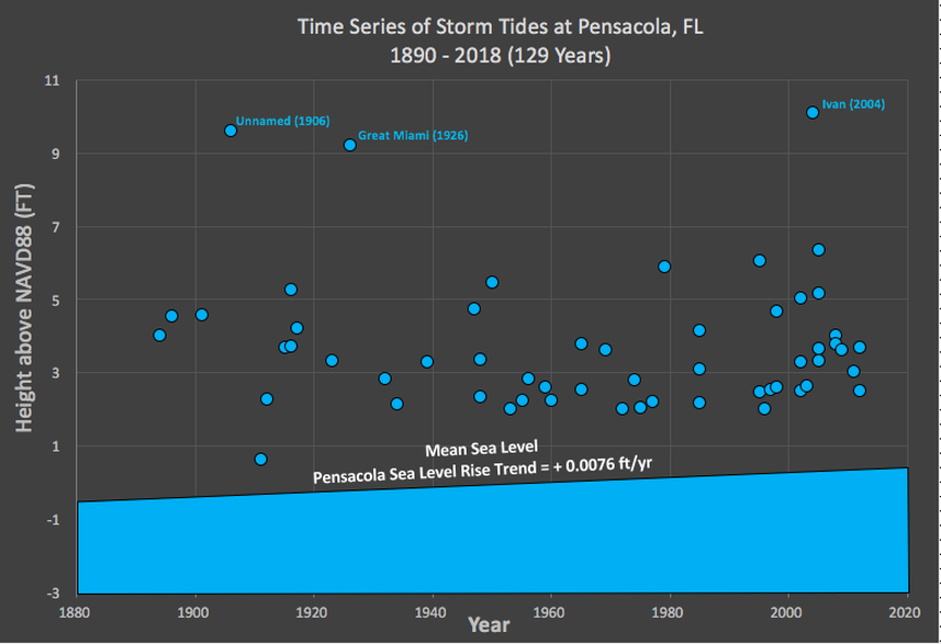
Time series of storm tide inundations at Pensacola, Florida. U-Surge provides high water marks for 55 hurricanes and tropical storms at Pensacola since 1880.
The U-Flood Project
Launched for Hurricanes Harvey and Irma
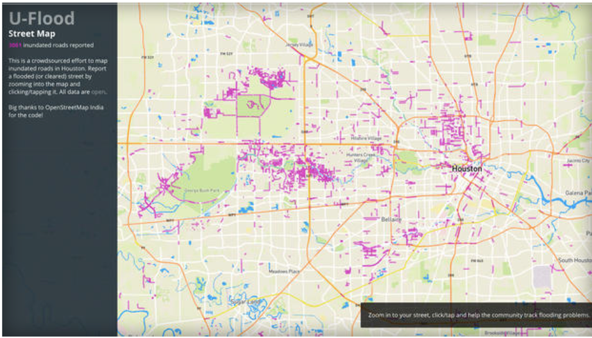
Marine Weather and Climate and Tailwind Labs have launched the U-Flood project to provide near real-time mapping of flooded streets during Hurricane Harvey. Click on the image above to start mapping flooded streets in your area.
Hurricane Field Work
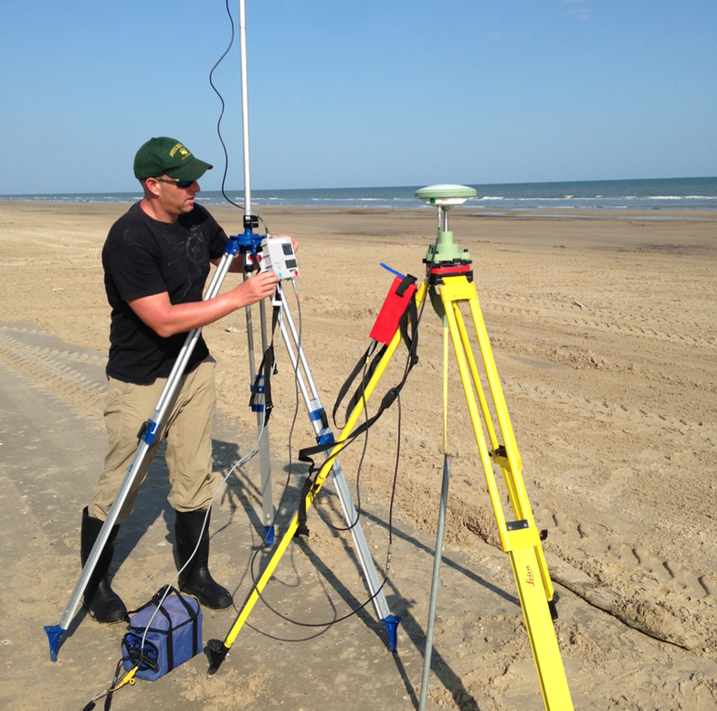
Marine Weather and Climate provided assistance on geomorphology fieldwork following Hurricane Harvey (2017). In this photo, Dr. Hal Needham set up an RTK system to provide accurate location data for conducting a beach profile, on a project with Rice University and Texas A&M Galveston.
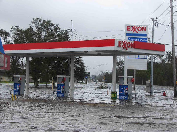
Dr. Hal Needham, Founder and President of Marine Weather and Climate, conducted field work during Hurricanes Gustav and Ike in 2008. He deployed instruments in the path of Hurricane Gustav's eyewall in Houma, Louisiana, on August 31, 2008. Less than two weeks later he documented Ike's massive coastal flooding in Louisiana and Texas. He took this storm surge photo in Orange, Texas, on September 13, 2008.
Texas Windstorm Insurance Association (TWIA)
Expert Panel (2016)
Marine Weather & Climate participated in a peer review of the Texas Windstorm Insurance Association (TWIA) Expert Panel's report, "A Proposed Methodology for Estimating Wind Damage to Residential Slab-Only Claims Resulting from a Hurricane Impacting the Texas Coastline." The expert panel in that report provided recommendations for determining the extent to which a loss to TWIA-insured property may be or was incurred as a result of wind, waves, tidal surges, or rising waters not caused by waves or surges. TWIA is the insurer of last resort for wind and hail insurance along the Texas coast and was created by the Texas Legislature in 1971.
Flood Risk Assessment
Property Owner in Mandeville, Louisiana (2015)
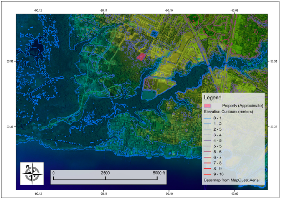
Marine Weather & Climate partnered with Disaster Map, LLC, to conduct a flood risk analysis for a property owner in Mandeville, Louisiana. This individual was constructing a new home, and used the flood analysis to determine the ideal height to elevate the structure.
Flood Risk Assessment for Nuclear Power Plant (2014)
Marine Weather & Climate provided analysis for storm surge risk assessment of a nuclear power plant along the U.S. Gulf Coast. This work was conducted as a subcontract from GZA GeoEnvironmental, Inc. Marine Weather & Climate provided historical data, statistical support, geospatial analysis and assistance with hurricane/ surge modeling.
Surge Data and Maps for Insurance Industry
Historical hazard data and maps are important tools the insurance industry uses to determine future risks. Marine Weather & Climate provided storm surge data, historical maps and geospatial products to Guy Carpenter, a leader in the re-insurance industry.
